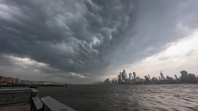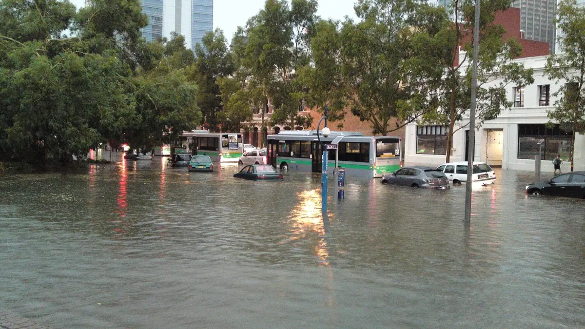
A DANA is a cut-off low: a pocket of very cold air high in the atmosphere, about 5,000 to 9,000 meters (16,000 to 30,000 feet) up, that breaks away from the jet stream and spins on its own over one region for days. The acronym stands for depresión aislada en niveles altos, Spanish for "isolated low at upper levels", and it is the term used by AEMET, Spain's national weather agency. When the news talks about a DANA in Spain, it usually means torrential rain and flash floods on the Mediterranean coast.
The DANA itself is not the danger. The trouble starts when that cold air sits over a sea still warm from summer and an easterly wind pushes moist air against the coast: storms then drop months of rain in hours.
Key takeaways
- DANA stands for depresión aislada en niveles altos: an upper-level low cut off from the jet stream, which meteorologists in English call a cut-off low.
- In Spain people often call it gota fría ("cold drop"), an older popular name now used for almost any torrential rain episode on the Mediterranean coast.
- Autumn is the riskiest season because the Mediterranean keeps the heat of summer, often above 25 °C (77 °F), and feeds storms with moisture and energy.
- On 29 October 2024 a DANA caused Spain's worst weather disaster in decades, with more than 220 deaths in the province of Valencia.
- During an orange or red rain warning, the key rules are: do not drive, never go down to garages or basements, and move to higher floors.
What does DANA mean in weather?
In weather, DANA means a low pressure area in the upper troposphere that has become isolated from the general westerly flow. Its core of air is much colder than its surroundings and shows up on 500 hPa charts, about 5,500 meters (18,000 feet) up, as a closed circle of very low temperatures.
At ground level you may notice nothing special at first. Unlike an ordinary low pressure system, with its center and fronts on the surface map, a DANA can sit above normal or even high pressure at the surface.
How does a DANA form?
A DANA forms from a wave in the jet stream, the river of fast wind that flows from west to east about 10 km (6 miles) above the ground. The jet buckles into a trough, a tongue of cold air dipping south; the trough deepens and its southern tip is pinched off, leaving an isolated pocket of cold air. Without the push of the jet, the DANA drifts slowly and erratically, sometimes even westward, and can stay over the same area for days. That erratic movement makes it hard to predict where the heaviest rain will fall.
Is a DANA the same as a cold drop (gota fría)?
A DANA and a gota fría (cold drop) refer to the same upper-level phenomenon, but they are used differently: DANA is the precise technical term, while gota fría is the traditional name that people apply to any torrential rain event on the Mediterranean, whether or not a DANA is behind it.
"Gota fría" translates the German Kaltlufttropfen, an expression from the German school of meteorology in the mid-20th century. Because not every Mediterranean downpour comes from an isolated low, AEMET prefers DANA when that specific structure exists.
| DANA | Gota fría (cold drop) | |
|---|---|---|
| Type of term | Technical, used by AEMET | Popular and traditional |
| What it describes | An isolated cold low at upper levels | Any Mediterranean torrential rain episode |
| Where you see it | Upper-air charts (500 hPa) | In the street: rain, floods, storms |
| Always brings rain? | No; it can bring only cold air or scattered storms | Always linked to heavy rain |
| Closest English term | Cut-off low | None |
AEMET and its partner services in Portugal, France, Belgium, Luxembourg and Andorra name high-impact DANAs from their storm list.
Why are DANAs so dangerous in autumn?
A DANA is especially dangerous in autumn because it coincides with the time when the Mediterranean is at its warmest: after summer, the sea surface often exceeds 25 °C (77 °F), and that warm water pumps huge amounts of water vapor and energy into the air above it.
The mechanism combines three ingredients:
- Very cold air aloft. The core of the DANA can be far colder than normal at 5,500 meters. The bigger the contrast with the warm air below, the more violent the storms.
- Warm, humid air at the surface. The warm sea loads the lowest layers of air with moisture.
- An easterly wind. The circulation around the DANA drives that moist air from the sea toward the coast, where coastal mountain ranges force it to rise, condense and fall as rain.
When these ingredients persist for hours over the same area, storms regenerate again and again in the same spot. Meteorologists call it a quasi-stationary convective system, or a "train" of storms, which can produce hundreds of millimeters of rain in a day. To picture what those amounts mean, see our guide to how rainfall is measured in millimeters and inches.
The same combination explains historic floods such as Valencia on 14 October 1957 and the Tous dam failure of 20 October 1982.
What happened in the Valencia DANA of October 2024?
On 29 October 2024, a DANA near the Strait of Gibraltar channeled a very moist easterly flow from the Mediterranean toward the province of Valencia, where stationary thunderstorms broke the national rainfall records of AEMET's station network.
AEMET's station at Turís, inland in the province, shows the scale of the event:
| Period | Rainfall at Turís |
|---|---|
| 1 hour | 185 mm (7.3 in) |
| 6 hours | 621 mm (24.4 in) |
| 12 hours | 720 mm (28.3 in) |
| 24 hours | 772 mm (30.4 in) |
According to AEMET, the 1-, 6- and 12-hour totals were new national records for its network. The one-hour figure is three times the 60 mm (2.4 in) used as a reference for torrential rain. The water fell on the upper reaches of ravines such as the Rambla del Poyo, and the flood wave reached towns south of Valencia city hours later, where it was barely raining.
More than 220 people died in the province of Valencia, with further deaths in Castilla-La Mancha and Andalusia.
The main lesson: in a DANA the danger is not only where it rains. A flash flood can rush down a dry ravine and reach places where the sky looks calm.
DANAs in 2025 and 2026
In October 2025, DANA Alice, the first DANA to receive a name, brought red warnings to parts of the Valencia region and the Balearic Islands. In October 2026, DANA Adam prompted red warnings again in parts of Valencia and Alicante.
When is DANA season in Spain?
DANAs can form in any month, but the flood risk on Spain's Mediterranean coast peaks in autumn, roughly September to November, when the sea is warmest. The most exposed areas are Valencia, Alicante, Murcia, Catalonia, the Balearics and eastern Andalusia. Most autumn days there are still mild and dry, so there is no need to cancel a trip: just check the forecast and warnings daily.
What should you do during a DANA in Spain?
During a DANA with an orange or red warning, the most important thing is to limit travel and stay away from riverbeds, ravines, underground garages and basements. Most flash flood victims die in vehicles or below street level.
- Check the official warnings. AEMET issues yellow, orange and red warnings for rainfall totals in 1 and 12 hours. Our guide to weather warning colors explains each level.
- Pay attention to ES-Alert. Civil Protection sends emergency messages to every phone in the affected area by cell broadcast, including foreign phones roaming on Spanish networks, usually in Spanish and English.
- Do not drive unless you have to. According to the US National Weather Service, 30 cm (12 in) of moving water can carry away most cars.
- Never cross a flooded street, ford or underpass, on foot or by car.
- Do not go down to garages or basements to move your car or belongings. Go up to higher floors.
- Stay away from ramblas, ravines and riverbeds, even if they are dry or it is not raining where you are.
In an emergency, call 112, the European emergency number, which works across Spain and is answered in English.
How to follow a DANA on Clima de Hoy
To follow a DANA, the rain forecast map shows in an hourly animation where the GFS model expects the rain bands to move over the coming hours and days. It is a forecast, not a live radar.
The hourly forecast for Valencia shows which hours should bring the heaviest rain, and the 7-day forecast for Murcia or the weather in Palma shows how long the episode will last. The exact spot of the heaviest rain is hard to forecast, so under a warning AEMET and Civil Protection are the reference.
Frequently asked questions
What does DANA stand for?
DANA stands for depresión aislada en niveles altos, Spanish for "isolated low at upper levels". It is a pocket of cold air high in the atmosphere that has broken away from the jet stream and moves slowly on its own for several days. In English it is called a cut-off low.
What is a cold drop in Spain?
"Cold drop" is the English translation of gota fría, the popular Spanish name for torrential rain episodes on the Mediterranean coast. Many are caused by a DANA, but AEMET reserves the word DANA for the specific upper-level low.
Is it safe to travel to Spain during a DANA?
Most DANAs bring a few days of rain and storms rather than disaster, and travel continues normally outside warned areas. Under an orange or red warning, avoid driving, stay away from riverbeds and basements, and follow ES-Alert messages. In an emergency, call 112.
How much rain fell in the Valencia DANA?
AEMET's station at Turís recorded 772 mm (30.4 in) of rain in 24 hours on 29 October 2024, including 185 mm (7.3 in) in a single hour. The 1-, 6- and 12-hour totals were national records for AEMET's network.
How long does a DANA last?
A DANA usually lasts two to five days, and some stay longer because they move so slowly. The heaviest rain tends to be concentrated in one or two days and in specific areas.
Weather in your city
- Weather in Ciudad de México
- Weather in Londres
- Weather in Nueva York
- Weather in Bogotá
- Weather in Madrid
- Weather in Buenos Aires
- Weather in París
- Weather in Barcelona
- Weather in Valencia
- Weather in Sevilla
- Weather in Málaga
- Weather in Bilbao