There are 10 basic types of clouds, called genera, in the World Meteorological Organization's (WMO) International Cloud Atlas: cirrus, cirrocumulus, cirrostratus, altocumulus, altostratus, nimbostratus, stratocumulus, stratus, cumulus and cumulonimbus. They are grouped into high, middle and low clouds by the height of their base, and each type tends to go with a certain kind of weather.
Knowing their names is more than trivia. Cirrus that thickens through the day can announce a front, and a cumulus that towers upward in the afternoon can become a thunderstorm within an hour or two.
Key takeaways
- The WMO recognizes 10 cloud genera in its International Cloud Atlas, first published in 1896 and updated online in 2017.
- In the middle latitudes, high clouds form at about 5 to 13 km (16,500 to 43,000 ft), middle clouds at 2 to 7 km (6,500 to 23,000 ft) and low clouds from the surface to about 2 km (6,500 ft).
- Nimbostratus brings steady rain or snow for hours; cumulonimbus brings heavy showers, lightning, hail and strong gusts.
- Mammatus and lenticular clouds are not separate genera but special forms of other clouds.
How do clouds form?
Clouds form when air rises, cools and reaches saturation, so its water vapor condenses into droplets or freezes into ice crystals around microscopic particles of dust, salt or smoke. Billions of those droplets, each a few thousandths of a millimeter across, make up the cloud you see.
Air is pushed upward in four main ways:
- Convection: the sun heats the ground and bubbles of warm air rise. This is how summer afternoon cumulus is born.
- Terrain: wind hits a mountain range and is forced up its slopes, creating cap clouds and lenticular clouds.
- Fronts: warm air slides up over cold air, or cold air lifts warm air, as explained in our guide to the cold front.
- Convergence: air flowing into a low pressure system has nowhere to go but up.
Cloud types and names: the 10 types of clouds chart
The 10 WMO cloud genera are ordered by the height of their base. The heights in this chart apply to the middle latitudes, such as the United States, the UK or Spain; in the tropics high clouds can sit higher, and in polar regions lower.
| Cloud | Abbreviation | Level | Usual base height | What it looks like | What it usually means |
|---|---|---|---|---|---|
| Cirrus | Ci | High | 5–13 km (16,500–43,000 ft) | Thin white wisps or streaks, like feathers | Fair weather; if it spreads and thickens, a front may arrive in 12–24 hours |
| Cirrocumulus | Cc | High | 5–13 km | Tiny white flakes without shading, often in rows | Stable weather; sometimes ahead of a change |
| Cirrostratus | Cs | High | 5–13 km | Thin, milky veil; makes halos around the sun or moon | Often announces an approaching warm front |
| Altocumulus | Ac | Middle | 2–7 km (6,500–23,000 ft) | Gray and white rounded masses with shading | Variable; on summer mornings, possible afternoon storms |
| Altostratus | As | Middle | 2–7 km | Gray or bluish sheet; the sun looks as if seen through frosted glass | Rain or snow on the way |
| Nimbostratus | Ns | Middle (extends to other levels) | Usually low, below 2 km | Thick, dark gray, uniform layer that hides the sun | Steady rain or snow for hours |
| Stratocumulus | Sc | Low | Up to 2 km (6,500 ft) | Gray patches or rolls with darker parts | Overcast, sometimes light drizzle |
| Stratus | St | Low | Surface to 2 km | Flat, featureless gray layer; lifted fog | Drizzle, gray skies, low hilltops hidden |
| Cumulus | Cu | Low (vertical growth) | A few hundred meters to 2 km | Puffy, cotton-like clouds with flat bases | Fair weather if small; showers if they grow tall |
| Cumulonimbus | Cb | Low (vertical growth) | A few hundred meters to 2 km | Huge tower, often with an anvil-shaped top | Thunderstorms, lightning, downpours, hail and gusts |
High clouds are made almost entirely of ice crystals, because at those heights the temperature is far below 0 °C (32 °F). Middle and low clouds are mostly water droplets, sometimes mixed with ice.
What do the cloud names mean?
Cloud names come from Latin words combined in a simple system proposed by the English chemist Luke Howard in 1803. Knowing five roots lets you decode all 10:
- Cirrus: curl or lock of hair (high, wispy).
- Cumulus: heap or pile (puffy).
- Stratus: layer or sheet (flat).
- Nimbus: rain cloud (the "nimbo" or "nimbus" part means it brings precipitation).
- Alto: from altus, high, though it is used for middle-level clouds.
So nimbostratus is a rain-bearing layer, and cumulonimbus is a rain-bearing heap.
Types of clouds and what they mean for the weather
The clouds that best announce a change in weather are the ones that arrive in sequence: cirrus turning into cirrostratus, then altostratus and finally nimbostratus. That progression from thin, high cloud to thick, low cloud is the classic signature of an approaching warm front and usually brings rain within 12 to 24 hours.
Other useful clues:
- A halo around the sun or moon means cirrostratus, often ahead of a front.
- Small turrets of altocumulus in the morning (the species castellanus) show instability aloft and possible afternoon thunderstorms.
- Cumulus growing fast around midday, with tops getting taller and sharper, can turn into cumulonimbus.
- Aircraft contrails that persist and spread indicate moist air high up. The WMO atlas classes them as cirrus homogenitus, clouds of human origin.
Are weather sayings about clouds reliable?
Weather sayings about clouds have a real basis but are only partly right. "Mackerel sky and mares' tails make tall ships carry low sails" refers to cirrocumulus and cirrus, which sometimes precede a front; if they thicken and lower, rain is likely, and if they fade, nothing happens. "Red sky at night, shepherd's delight" works best where weather moves from west to east, but the color depends on clouds and dust on the horizon and is not reliable on its own.
What are cumulonimbus clouds?
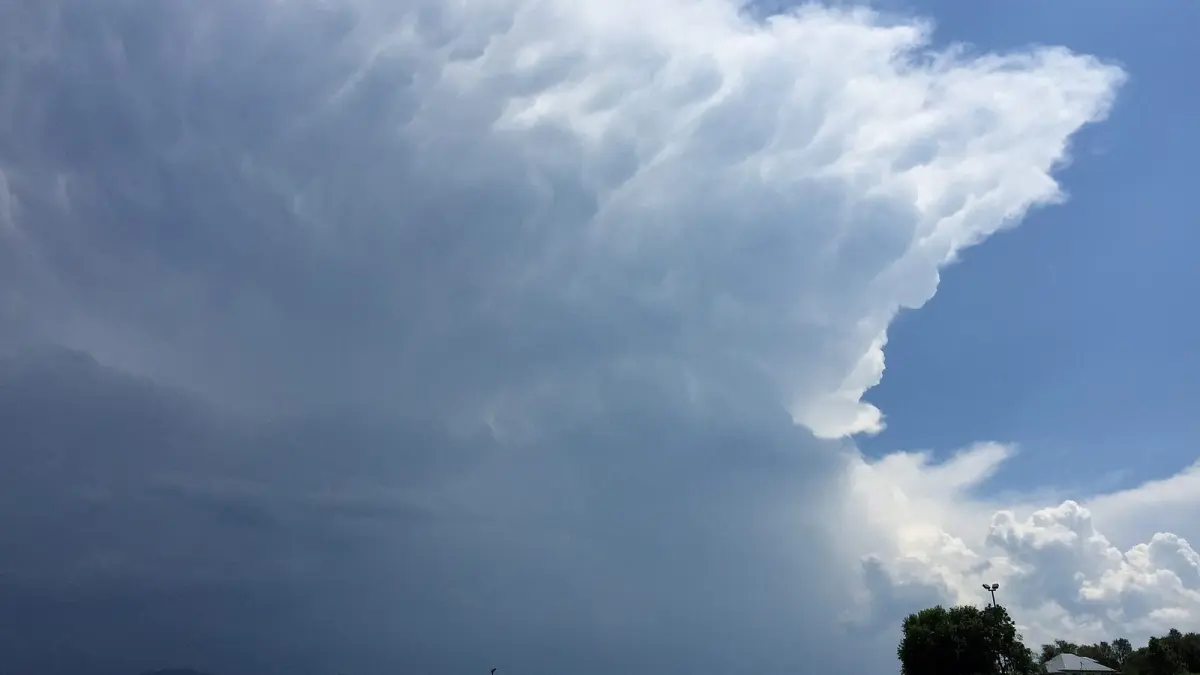
Cumulonimbus clouds are thunderstorm clouds: towering clouds whose tops can rise above 10 km (33,000 ft), producing lightning, thunder, heavy downpours, hail and violent gusts. Cumulonimbus is the only cloud genus associated with thunderstorms. It is pronounced "kyoo-myuh-loh-NIM-bus".
It grows from a cumulus that keeps building while warm, moist air rises strongly. When it reaches the tropopause, the ceiling of the lower atmosphere, it cannot rise further and spreads out sideways. That flat, frayed top is the anvil, which the atlas calls incus: a "cumulonimbus incus" is simply a mature storm cloud with an anvil.
The atlas splits the genus into two species. Cumulonimbus calvus has a top that is still rounded and bald, with no fibrous ice yet. Cumulonimbus capillatus has a fibrous, streaky upper part, usually an anvil, and is the more mature stage.
Inside, strong updrafts and downdrafts keep ice particles suspended until they grow heavy enough to fall as hail, which our guide on how hail forms explains, and the separation of electric charge produces lightning. If you see one approaching, read what to do in a thunderstorm.
Cumulonimbus vs nimbostratus
Both clouds bring rain, but in very different ways. Nimbostratus is a wide, flat, gray layer that gives steady, moderate rain or snow for hours, with no lightning. Cumulonimbus is a tall, isolated tower that gives short, intense showers, often with thunder, hail and squalls. If the rain is steady and the sky is uniformly gray, it is nimbostratus; if it starts suddenly, pours and stops, it is cumulonimbus.
What are mammatus and lenticular clouds?
Mammatus and lenticular clouds are not cloud genera but special forms that some genera take. The WMO atlas lists them as supplementary features or species of other clouds.
Mammatus clouds
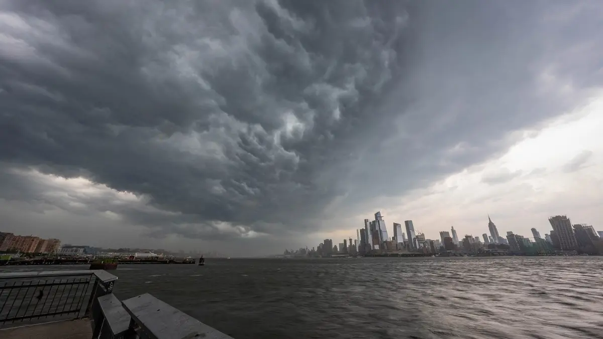
Mammatus clouds (mamma in the atlas) are rounded pouches hanging from the base of a cloud, like an upside-down sheet of bubbles. They appear mostly under the anvil of a cumulonimbus, where cold air loaded with ice and droplets sinks out of the cloud. They are most striking in low evening light.
Mammatus clouds are not dangerous in themselves and do not mean a tornado is coming. They do tell you a strong thunderstorm is nearby or has just passed, so watch for gusts, hail or lightning. They can be seen wherever thunderstorms occur, including the UK, and are not as rare as their dramatic look suggests.
Lenticular clouds
Lenticular clouds are lens- or saucer-shaped, with very smooth edges, and form downwind of mountains when strong, steady wind creates waves in the air. The air condenses at the crest of each wave and evaporates as it sinks, so the cloud seems frozen in place even though the wind is blowing hard. For pilots they are a sign of turbulence.
In 2017 the online edition of the WMO atlas added new forms, such as asperitas, a chaotic, wave-like underside that looks like a rough sea seen from below, and volutus, the roll cloud.
How to use Clima de Hoy to read the sky
What you see in the sky makes more sense next to the forecast. If turreted altocumulus appears in the morning, open the hourly forecast for Madrid or your own city and check the chance of afternoon showers.
The rain forecast map includes a cloud and precipitation layer from the GFS model, useful to see whether a band of cloud is heading your way or staying offshore. In summer, the hourly forecast for Miami shows the typical pattern of sunny mornings and afternoon storms from towering cumulonimbus.
Frequently asked questions
How many types of clouds are there?
According to the WMO International Cloud Atlas, there are 10 cloud genera: cirrus, cirrocumulus, cirrostratus, altocumulus, altostratus, nimbostratus, stratocumulus, stratus, cumulus and cumulonimbus. Each genus is further divided into species and varieties, which describe shape and arrangement in more detail.
Which clouds bring rain?
The main rain clouds are nimbostratus, which gives steady rain or snow, and cumulonimbus, which gives heavy showers and thunderstorms. Altostratus, stratocumulus, stratus and large cumulus can give light rain, drizzle or brief showers.
What is the highest type of cloud?
Among the 10 genera, the high clouds are cirrus, cirrocumulus and cirrostratus, which form at about 5 to 13 km (16,500 to 43,000 ft) in the middle latitudes. Cumulonimbus has a low base, but its top can reach higher than many high clouds.
What do mammatus clouds mean?
Mammatus clouds mean there is a thunderstorm cloud nearby, usually a cumulonimbus, with cold, moist air sinking from under its anvil. They are harmless in themselves and do not signal a tornado, but the storm that produces them can bring gusts, hail and lightning to the area.
Weather in your city
- Weather in Ciudad de México
- Weather in Londres
- Weather in Nueva York
- Weather in Bogotá
- Weather in Madrid
- Weather in Buenos Aires
- Weather in París
- Weather in Barcelona
- Weather in Valencia
- Weather in Sevilla
- Weather in Málaga
- Weather in Bilbao