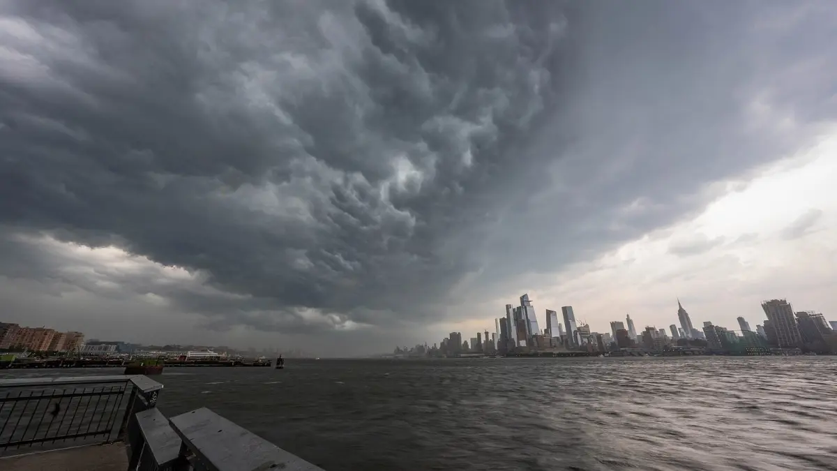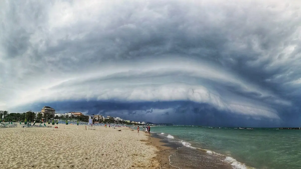
A cold front is the leading edge of an advancing mass of cold air that pushes out the warmer air in its path. Because cold air is denser, it wedges under the warm air and forces it up sharply, which builds towering clouds, showers and sometimes thunderstorms, followed by a clear drop in temperature once the front has passed.
On a weather map a cold front is drawn as a blue line with triangles pointing in the direction it is moving. It usually trails from the center of a low pressure system and can sweep across a whole country in a day or two.
Key takeaways
- A cold front is the boundary where cold air overtakes and lifts warm air; on weather maps it is a blue line with triangles.
- Before it arrives the pressure falls and a mild wind blows; as it passes come showers and gusts; after it the temperature drops and the sky clears.
- Cold fronts often move at around 20 to 30 mph (30 to 50 km/h), roughly twice as fast as warm fronts, which is why they catch up with them and form occluded fronts.
- In a warm front, warm air rises gently over cold air and brings lighter, longer-lasting rain over a wider area.
- Mexico's National Weather Service (SMN) numbers every cold front of the season and forecast 56 for September 2026 to May 2027.
What is a cold front in weather?
In weather, a cold front forms when a mass of cold air, often of polar origin, moves faster than the warm air ahead of it and pushes it upward. The front is the contact zone between the two air masses, and it extends from the ground up to several kilometers high.
Since cold air is denser, it advances close to the ground like a wedge. The surface of the front is steep, so the warm air is lifted abruptly: tall cumulus and cumulonimbus clouds form in a narrow band. Sometimes the front is marked by a squall line, a row of thunderstorms with strong gusts, or by a low, menacing shelf cloud on the horizon.
What weather does a cold front bring?
A cold front brings a quick change in three stages: worsening weather before it arrives, showers and wind as it passes, and cooler, cleaner air behind it. It can all happen in a few hours.
| Stage | Pressure | Wind (Northern Hemisphere) | Temperature | Sky and precipitation |
|---|---|---|---|---|
| Before | Falling | From the south or southwest, sometimes strong | Mild, sometimes rising | Increasing clouds |
| As it passes | Lowest, then starts to rise | Veers sharply to west or northwest, with gusts | Drops quickly | Cumulonimbus, heavy showers, possible hail and thunderstorms |
| After | Rising | From the northwest or north | Lower, possible night frost | Clearing, scattered cumulus, very clear air |
In the Southern Hemisphere the pattern is mirrored: winds ahead of the front blow from the north or northwest and swing to the southwest or south behind it. To recognize the clouds of each stage, see our guide to types of clouds.
How long does a cold front take to pass?
A cold front usually takes from under an hour to a few hours to pass over one place, because its band of rain is narrow. What lasts longer is the cold air it leaves behind, which can stay for one or several days until the next system arrives.
Cold front vs warm front: what is the difference?
The difference between a cold front and a warm front is which air mass is advancing: in a cold front, cold air pushes under warm air and lifts it steeply; in a warm front, warm air slides slowly up over cold air. That changes the clouds, the rain and the speed.
| Cold front | Warm front | |
|---|---|---|
| Map symbol | Blue line with triangles | Red line with semicircles |
| What advances | Cold air replaces warm air | Warm air replaces cold air |
| Slope of the front | Steep | Gentle |
| Typical speed | Faster, often 20-30 mph (30-50 km/h) | Slower, often 10-25 mph (15-40 km/h) |
| Clouds | Cumulus and cumulonimbus in a narrow band | Cirrus, then altostratus and nimbostratus over a wide area |
| Precipitation | Short, heavy showers, thunderstorms, hail | Light to moderate, steady rain or snow |
| After it passes | Cooler, drier, clearer | Milder and more humid |
What is an occluded front?
An occluded front forms when a cold front catches up with the warm front ahead of it and lifts the warm air completely off the ground. On a map it is a purple line with triangles and semicircles on the same side. It usually appears as a low matures and begins to weaken, and it brings cloud and rain that can resemble either type of front.
A stationary front is one that has stopped moving. It is drawn with alternating red semicircles and blue triangles on opposite sides of the line, and it can leave clouds and rain over the same area for days. Our guide on how to read a weather map explains all the symbols.
Cold fronts around the world
Cold fronts reach most of the world outside the tropics, and in some places they have their own names.
- United States. Fronts that sweep south across the Great Plains can drop temperatures by 20 °F (11 °C) or more within hours. In Texas a strong, fast front under a dark blue sky is called a blue norther. In spring, cold fronts meeting warm, humid air from the Gulf of Mexico help trigger severe thunderstorms.
- United Kingdom and Ireland. Fronts arrive from the Atlantic with the lows that cross the islands. Behind them, cooler polar air brings bright spells and blustery showers, often with hail or snow on the hills in winter.
- Spain. Atlantic fronts enter through Galicia and leave most of their rain in the west and north. By the time they reach Valencia or Murcia they are usually weak, because the Iberian Peninsula acts as a barrier.
- Australia. In Sydney, the southerly buster is a sudden change behind a shallow cold front. The Bureau of Meteorology's criteria include gusts above 54 km/h (34 mph) and a temperature fall of at least 5 °C (9 °F) within three hours.
Cold fronts in Mexico: the "nortes"
In Mexico, the SMN numbers every cold front so each one can be clearly identified in its warnings, from "cold front number 1" each September through May. For the 2026-2027 season it forecast 56 fronts, above the climatological average of about 50, with December the busiest month at nine.
Behind the fronts that cross the Gulf of Mexico blow the nortes, strong north winds that hit the coasts of Tamaulipas, Veracruz and Tabasco and reach the Yucatán Peninsula. If you are traveling to Cancun between November and March, a norte can mean a few cooler, windy days with rough seas. In Monterrey a front can bring a drop of many degrees in a few hours.
How do you know a cold front is coming?
To know whether a cold front is approaching, watch the pressure, the wind and the sky: pressure falls, the wind strengthens from the south or southwest (in the Northern Hemisphere) and clouds build and darken to the west. When the front arrives, the wind changes direction abruptly and the temperature drops.
Practical signs:
- Barometer: falls steadily for hours and rises quickly once the front has passed.
- Horizon: a dark line of storm clouds advancing, sometimes with an arc of low cloud ahead of it.
- Wind: sudden gusts and a change of direction within minutes.
- Temperature: a fall of several degrees in less than an hour.
For pilots and sailors, cold fronts also bring turbulence, wind shear and sudden squalls, so check the aviation or marine forecast before setting out.
How to follow a cold front on Clima de Hoy
On Clima de Hoy you can follow a cold front hour by hour in your city. The hourly forecast for London shows when the wind veers and the temperature drops as an Atlantic front goes through. The 7-day forecast for Monterrey shows the temperature plunge behind a Mexican front, and the 7-day forecast for Cancun shows how long a norte will last.
The rain forecast map animates the precipitation and wind forecast by the GFS model, so you can watch a front's rain band move across the map. For official warnings, check your national weather service.
Frequently asked questions
What is a cold front in simple terms?
A cold front is the line where cold air pushes into an area of warm air and forces it upward. The rising warm air forms storm clouds and showers, and after the front passes the temperature falls and the sky clears.
What is the symbol for a cold front?
A cold front is drawn as a blue line with blue triangles along one side. The triangles point in the direction the front is moving, which tells you where the cold air is heading next.
How long does a cold front last?
The rain band of a cold front usually passes over one place in under an hour to a few hours. The colder air behind it can last for one or several days, until another air mass or the next front replaces it.
What is the difference between a cold front and a warm front?
In a cold front, cold air pushes warm air up sharply, which brings heavy showers and thunderstorms in a narrow band, then cooler air. In a warm front, warm air rises gently over cold air, bringing lighter, steady rain over a wider area and a gradual rise in temperature.
What is an occluded front?
An occluded front forms when a faster cold front catches up with a warm front and lifts the warm air off the ground. It is shown in purple with triangles and semicircles on the same side, and it often marks a low that is reaching maturity.
Weather in your city
- Weather in Ciudad de México
- Weather in Londres
- Weather in Nueva York
- Weather in Bogotá
- Weather in Madrid
- Weather in Buenos Aires
- Weather in París
- Weather in Barcelona
- Weather in Valencia
- Weather in Sevilla
- Weather in Málaga
- Weather in Bilbao