To read weather radar, look at the colors, which show how strong the returned signal is: blues and greens mean light rain, yellows and oranges moderate to heavy rain, and reds, purples or whites intense downpours and possible hail. Then play the animation to see which way the rain is moving and how fast, which tells you whether and when it will reach you.
A weather radar sends out pulses of microwaves and measures the echo bounced back by raindrops, snowflakes and hailstones. Knowing what the image can and cannot show helps you decide whether to leave now or in half an hour, and explains why the radar sometimes shows rain when none is falling.
Key takeaways
- Weather radar measures reflectivity, the energy bounced back by precipitation, in a logarithmic unit called dBZ.
- The US National Weather Service runs 159 WSR-88D Doppler radars (NEXRAD); the Met Office runs 15 operational radars across the UK.
- Higher dBZ means heavier rain: about 20 dBZ is light rain, 40 dBZ heavy rain and above 55 dBZ an intense storm core that often contains hail.
- Doppler velocity images show wind toward or away from the radar; tight red-green pairs can reveal rotation inside a storm.
- Radar sees precipitation inside clouds from the ground, while satellites see clouds from above.
How does weather radar work?
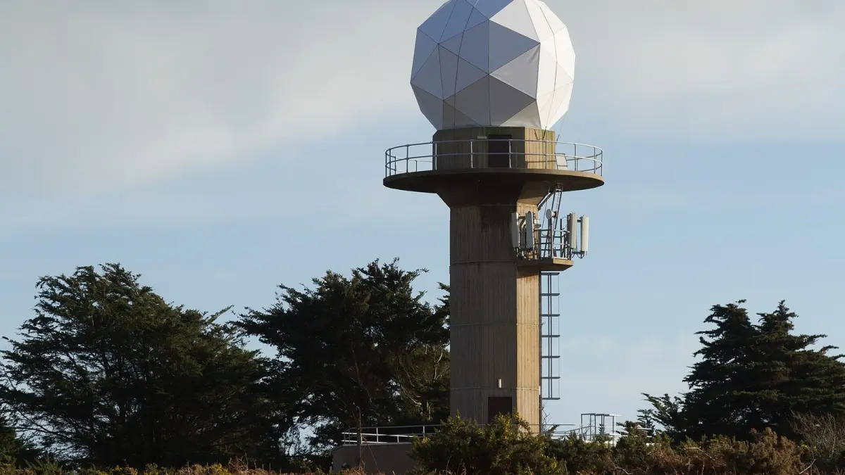
Weather radar works like an echo: a rotating antenna sends out very short microwave pulses, the pulses bounce off precipitation, and the radar measures how much energy comes back and how long it takes. The return time gives the distance; the amount of energy gives the intensity.
The antenna turns through 360 degrees at several elevation angles, scanning a large volume of the atmosphere in a few minutes. The NWS radars complete a full volume scan in roughly 4 to 10 minutes depending on the scanning mode. They operate in the S band, with a wavelength of about 10 cm, while the radars of the Met Office and of Spain's AEMET use the C band, about 5 cm.
How does Doppler radar work?
Doppler radar also measures the slight shift in frequency of the returning signal, which reveals whether precipitation is moving toward or away from the antenna and how fast. That lets forecasters estimate the wind inside a storm, not just the rain. Modern dual-polarization radars, now standard in the US and UK networks, send pulses in two orientations to tell rain, snow, hail and non-weather targets apart.
What do weather radar colors mean?
Weather radar colors represent reflectivity in dBZ (decibels of reflectivity): the higher the value, the larger or more numerous the drops and the heavier the precipitation. Every service and app uses its own palette, but almost all follow the order blue, green, yellow, orange, red and purple.
| Reflectivity | Usual color | Approximate rain rate | What it means |
|---|---|---|---|
| 10–20 dBZ | Light blue | Under 1 mm/h (0.04 in/h) | Drizzle or very light rain, may not reach the ground |
| 20–30 dBZ | Blue or green | 0.5–3 mm/h (0.02–0.12 in/h) | Light rain |
| 30–40 dBZ | Green or yellow | 3–12 mm/h (0.12–0.5 in/h) | Moderate rain |
| 40–50 dBZ | Orange | 12–50 mm/h (0.5–2 in/h) | Heavy rain or showers |
| 50–55 dBZ | Red | 50–100 mm/h (2–4 in/h) | Very heavy downpour, thunderstorm |
| Above 55 dBZ | Purple or white | Over 100 mm/h (4 in/h) or hail | Storm core, hail likely |
The rain rates are approximate: they come from a standard relationship between reflectivity and rainfall that works well for ordinary rain but not for hail or snow. Above about 55 dBZ, the echo is more likely to come from ice than water, as we explain in how hail forms. To turn millimeters or inches per hour into something tangible, see how rainfall is measured.
What do red and purple mean on weather radar?
Red on weather radar means very heavy rain, typically from a thunderstorm, and purple or white marks the strongest echoes, above about 55 dBZ, which often means hail. If a red or purple core is heading your way, expect an intense downpour, possibly with hail, lightning and strong gusts, and get indoors.
What colors show snow on weather radar?
Many radar apps switch to a separate winter palette, often blues for snow and pinks or purples for a wintry mix, using temperature data or dual-polarization to guess the type. Check the legend, because the same color can mean rain in one app and snow in another.
How do you read weather radar velocity?
On a velocity image, colors show wind speed toward or away from the radar, not rain intensity. In the traditional color scheme, green means motion toward the radar and red means motion away from it, with brighter shades for faster winds; some apps use other colors, so check the legend.
The key pattern is a couplet: bright red and bright green right next to each other inside a storm. That means air is moving in opposite directions over a short distance, a sign of rotation. Forecasters often prefer storm-relative velocity, which subtracts the storm's own motion so the rotation stands out.
How to read weather radar for tornadoes
On reflectivity, the classic tornado signature is a hook echo, a curl of precipitation wrapped around the back of a rotating supercell. On velocity, it is a tight, strong couplet near the ground. Dual-polarization radars can also detect a debris ball, a small area where the radar sees objects lofted by a tornado rather than raindrops. Not every hook produces a tornado and some tornadoes are hidden in rain, so always follow official tornado warnings rather than your own reading of the radar.
How do you tell when rain will reach you?
To tell when rain will arrive, play the radar animation in a loop and watch three things: the direction the echoes move, their speed and whether they grow or weaken. A single image tells you where it is raining; the animation tells you where it is going to rain.
- Find the leading edge of the approaching rain and your own position.
- Measure how far that edge moved between the first and last frame.
- Divide the remaining distance by that speed. If the edge is 20 miles (32 km) away and moved 5 miles (8 km) in 15 minutes, it should arrive in about an hour.
- Repeat every few minutes: storms change direction, slow down and fall apart.
Summer thunderstorms can form and die within an hour, so this only works for the short term; rain bands along a front move more steadily.
What are the limits of rain radar?
Rain radar has physical limits, so the image is never a perfect picture of what is falling at street level.
- Beam height: the beam travels in a straight line while the Earth curves away, so 200 km (124 mi) from the radar it is more than 3 km (2 mi) above the ground and misses low drizzle.
- Mountain shadows: ranges block the beam and leave valleys poorly covered.
- False echoes: buildings, hills, wind turbines, sea waves, birds and insects can appear as rain.
- Virga: in dry air, rain evaporates before reaching the ground. The radar sees it aloft, but nothing falls where you are.
- Attenuation: an intense storm core absorbs part of the signal, especially at C band, so rain behind it looks weaker than it is.
- Bright band: where snow melts into rain, wet flakes reflect strongly and the radar overestimates intensity.
What is the difference between radar and satellite?
Radar measures precipitation from the ground, looking inside clouds, while a weather satellite photographs clouds from space, looking down on their tops. A huge cloud on satellite may produce no rain at all, and light rain under low cloud can be hard to spot on a satellite image.
| Weather radar | Weather satellite | |
|---|---|---|
| What it measures | Precipitation: rain, snow, hail | Clouds, water vapor, cloud-top temperature |
| Where from | Ground-based antennas | Orbit, such as NOAA's GOES or EUMETSAT's Meteosat |
| Coverage | A few hundred kilometers around each radar | Whole continents and oceans |
| Best for | Rain and storms over the next few hours | Storm systems, fronts and weather over the sea |
What does the Clima de Hoy rain map show?
The Clima de Hoy rain forecast map is not a live radar: it is an animated map of the precipitation, wind, temperature and clouds forecast by NOAA's global GFS model, updated every 6 hours, hour by hour for the first 24 hours and every 3 hours after that. It complements a live radar, which shows the rain falling now, by showing how rain is expected to develop over the next hours and days.
Combine it with the hourly forecast for Miami or the hourly forecast for London, which give the chance of rain and the expected amount for each hour. For rain falling right now, use the radar of your national weather service. And if you hear thunder, follow what to do in a thunderstorm even if the radar shows no rain over you yet: lightning can strike about 10 miles (16 km) from the rain.
Frequently asked questions
How often does weather radar update?
Each NWS radar completes a full scan roughly every 4 to 10 minutes, depending on its scanning mode. Spain's AEMET refreshes each regional radar image every 10 minutes. Apps may add a few minutes of delay while they process and combine the images.
Why does the radar show rain when it is not raining?
Usually for one of three reasons: the rain evaporates before reaching the ground because the air below is dry, the beam is sampling precipitation thousands of feet up, or the echo is false, caused by hills, buildings, wind turbines or even birds. The rain may also be very local and falling a few hundred meters away.
Can weather radar see snow?
Yes, but less accurately than rain. Dry snowflakes return less energy and appear weaker than the actual snowfall, while in the melting layer wet flakes make the intensity look exaggerated. Many apps use a separate color scale for snow and mixed precipitation.
Weather in your city
- Weather in Ciudad de México
- Weather in Londres
- Weather in Nueva York
- Weather in Bogotá
- Weather in Madrid
- Weather in Buenos Aires
- Weather in París
- Weather in Barcelona
- Weather in Valencia
- Weather in Sevilla
- Weather in Málaga
- Weather in Bilbao