The Beaufort wind scale measures wind strength in 13 steps, from force 0 (calm, less than 1 mph) to force 12 (hurricane force, 64 knots or 73 mph and above), based on the wind's visible effects at sea and on land. It was devised in 1805 by Francis Beaufort, an officer of the British Royal Navy, and is still used by the Met Office, the National Weather Service, the Bureau of Meteorology and weather services worldwide in marine forecasts. Each force number matches a range of mean wind speed in knots, mph, km/h or meters per second.
Key takeaways
- The Beaufort scale ranks wind in 13 forces, from 0 (calm) to 12 (hurricane force), by mean wind speed.
- Force 7 (near gale) starts at 28 knots (32 mph); force 8 (gale) at 34 knots (39 mph); force 12 at 64 knots (73 mph).
- The scale describes the mean wind, averaged over 10 minutes at 10 meters (33 feet) above the ground; gusts are short peaks of about 3 seconds and can be much stronger.
- Sea state is described with the Douglas scale, from 0 (calm) to 9 (phenomenal, waves over 14 meters or 46 feet).
- In the US, the National Weather Service issues a Gale Warning for 34 to 47 knots and a Storm Warning for 48 to 63 knots.
What is the Beaufort scale?
The Beaufort scale is an empirical scale of wind force based on what you can see: smoke, tree leaves, flags and the foam on waves. Francis Beaufort designed it in 1805 around the sails of a warship, and the Royal Navy adopted it officially in 1838.
Speed equivalents and effects on land were added later. Today the scale is alive mainly at sea. When the Met Office Shipping Forecast says "southwest 7 to severe gale 9", those numbers are Beaufort forces.
Two conversions are worth remembering: a knot is one nautical mile per hour, or 1.15 mph (1.852 km/h), and 1 m/s equals 2.24 mph (3.6 km/h).
Beaufort scale chart: mph, knots and km/h
This Beaufort scale chart shows the 13 forces with the English names used by the Met Office and their equivalents in the most common units:
| Force | Name | Knots | mph | km/h | m/s |
|---|---|---|---|---|---|
| 0 | Calm | less than 1 | less than 1 | less than 1 | 0–0.2 |
| 1 | Light air | 1–3 | 1–3 | 1–5 | 0.3–1.5 |
| 2 | Light breeze | 4–6 | 4–7 | 6–11 | 1.6–3.3 |
| 3 | Gentle breeze | 7–10 | 8–12 | 12–19 | 3.4–5.4 |
| 4 | Moderate breeze | 11–16 | 13–18 | 20–28 | 5.5–7.9 |
| 5 | Fresh breeze | 17–21 | 19–24 | 29–38 | 8.0–10.7 |
| 6 | Strong breeze | 22–27 | 25–31 | 39–49 | 10.8–13.8 |
| 7 | Near gale | 28–33 | 32–38 | 50–61 | 13.9–17.1 |
| 8 | Gale | 34–40 | 39–46 | 62–74 | 17.2–20.7 |
| 9 | Strong (severe) gale | 41–47 | 47–54 | 75–88 | 20.8–24.4 |
| 10 | Storm | 48–55 | 55–63 | 89–102 | 24.5–28.4 |
| 11 | Violent storm | 56–63 | 64–72 | 103–117 | 28.5–32.6 |
| 12 | Hurricane force | 64 or more | 73 or more | 118 or more | 32.7 or more |
The force 12 threshold, 64 knots, is the same one that separates a tropical storm from a hurricane; the National Hurricane Center rounds it to 74 mph. Our guide on how hurricanes form explains why such winds are only sustained in tropical cyclones. The Met Office officially calls force 9 "strong gale" but uses "severe gale" in its forecasts.
Beaufort wind scale on land and at sea
Each Beaufort force has typical effects that let you estimate the wind without an anemometer. The wave heights shown are the probable ones in the open sea, far from the coast, once the wind has blown long enough:
| Force | On land | At sea | Probable wave |
|---|---|---|---|
| 0 | Smoke rises vertically | Sea like a mirror | 0 m |
| 1 | Smoke drifts, wind vanes do not move | Small ripples without foam | 0.1 m (4 in) |
| 2 | Wind felt on face, leaves rustle | Small wavelets, crests do not break | 0.2 m (8 in) |
| 3 | Leaves and twigs in constant motion, flags extend | Crests begin to break, scattered whitecaps | 0.6 m (2 ft) |
| 4 | Dust and loose paper lift, small branches move | Longer waves, frequent whitecaps | 1 m (3 ft) |
| 5 | Small trees sway | Moderate waves, many whitecaps | 2 m (7 ft) |
| 6 | Large branches move, wires whistle, umbrellas hard to use | Large waves, white foam crests | 3 m (10 ft) |
| 7 | Whole trees move, hard to walk against the wind | Foam blown in streaks | 4 m (13 ft) |
| 8 | Twigs break off trees, walking is very difficult | High waves, crests break into spindrift | 5.5 m (18 ft) |
| 9 | Slight damage to roofs and chimneys | Very high waves, spray reduces visibility | 7 m (23 ft) |
| 10 | Trees uprooted, considerable structural damage | Sea white with foam, very high waves | 9 m (30 ft) |
| 11 | Widespread damage, very rare inland | Exceptionally high waves | 11.5 m (38 ft) |
| 12 | Devastation | Air filled with foam and spray | 14 m (46 ft) or more |
On land, forces 10 to 12 are rare as mean winds, except on mountain tops, in tropical cyclones and in the deepest lows. Gusts can reach those values, though, during a bomb cyclone or a severe winter storm.
What does gale force winds mean?
Gale force winds are mean winds of force 8 on the Beaufort scale, 34 to 40 knots (39 to 46 mph or 62 to 74 km/h). In everyday use, "gale force" often covers forces 8 to 9, and the Met Office also counts it as a gale when gusts reach 43 to 51 knots, even if the mean wind is lower.
Marine warnings are built on these thresholds, though each country words them slightly differently:
| Warning | National Weather Service (US) | Bureau of Meteorology (Australia) |
|---|---|---|
| Strong wind | Small Craft Advisory (local thresholds) | 26–33 knots |
| Gale | 34–47 knots | 34–47 knots |
| Storm | 48–63 knots | 48–63 knots |
| Hurricane force | 64 knots or more | 64 knots or more |
In the US these products apply to winds not directly tied to a tropical cyclone; for those, the National Hurricane Center issues tropical storm and hurricane warnings instead. November is a notorious month for gales on the Great Lakes: the freighter Edmund Fitzgerald sank in a storm on Lake Superior on 10 November 1975.
What is the Douglas sea scale?
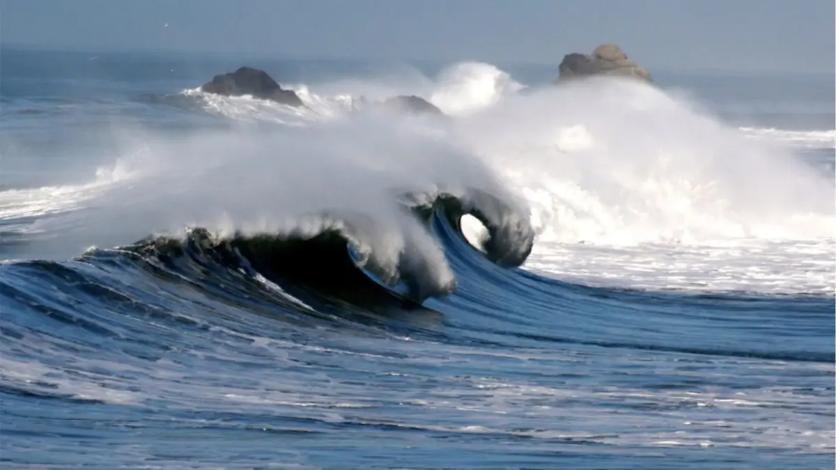
The Douglas sea scale describes the state of the sea by the height of wind waves, while the Beaufort scale describes the wind that raises them. The two are used together in marine forecasts, and the Met Office Shipping Forecast uses the Douglas terms ("moderate", "rough", "very rough") for sea state.
| Douglas | Description | Wave height |
|---|---|---|
| 0 | Calm (glassy) | 0 m |
| 1 | Calm (rippled) | 0–0.1 m (0–4 in) |
| 2 | Smooth | 0.1–0.5 m (4 in–1.6 ft) |
| 3 | Slight | 0.5–1.25 m (1.6–4 ft) |
| 4 | Moderate | 1.25–2.5 m (4–8 ft) |
| 5 | Rough | 2.5–4 m (8–13 ft) |
| 6 | Very rough | 4–6 m (13–20 ft) |
| 7 | High | 6–9 m (20–30 ft) |
| 8 | Very high | 9–14 m (30–46 ft) |
| 9 | Phenomenal | more than 14 m (46 ft) |
The link is not automatic: near the coast or in an enclosed sea, the same wind raises smaller waves than in the open ocean, because it blows over less water. Swell from a distant storm can also arrive with no local wind.
What is the difference between mean wind and gusts?
Mean wind is the speed averaged over 10 minutes, measured 10 meters (33 feet) above the ground, while gusts are brief peaks, defined by the WMO as the highest average over about 3 seconds. The Beaufort scale applies to the mean wind. US agencies such as the National Hurricane Center use a 1-minute average for sustained winds, so figures from different countries are not always directly comparable.
Gusts are what bring down branches, move trash cans and push a truck sideways on a bridge. With a mean wind of force 6, about 28 mph (45 km/h), gusts above 45 mph (70 km/h) are common on an exposed coast. That is why warnings on land, such as those from the Met Office, focus on gust speeds; our guide to weather warning colors explains what yellow, amber and red mean.
What to do in strong winds
- Avoid walking near trees, scaffolding, ledges and weak walls.
- Bring in or tie down plant pots, awnings and loose objects on balconies and in yards.
- On the road, slow down and grip the wheel firmly, especially on bridges and at tunnel exits; take care around motorcycles, trailers and high-sided vehicles.
- On the coast, stay away from piers, breakwaters and seafronts exposed to waves.
How to check the wind with Clima de Hoy
Clima de Hoy shows wind speed and direction for each city, hour by hour in the hourly view and day by day in the 7 and 14 day forecasts. Use the chart above to convert it to a Beaufort force: if the hourly forecast for London shows 55 km/h (34 mph), that is force 7, a near gale.
To follow the wind of a storm across the map, the rain, wind and cloud forecast map shows how it develops over the coming days. These are mean wind values from the model: for gusts and warnings, check your national weather service as well.
Frequently asked questions
What is force 7 on the Beaufort scale in mph?
Force 7, called near gale, is a mean wind of 32 to 38 mph, which is 28 to 33 knots or 50 to 61 km/h. On land, whole trees move and it is hard to walk into the wind. At sea, waves of about 4 meters (13 feet) form, with foam blown in streaks.
What is the highest number on the Beaufort scale?
The highest number on the standard Beaufort scale is 12, hurricane force, with mean winds of 64 knots (73 mph or 118 km/h) or more. It matches the wind threshold for a hurricane. Some countries in East Asia use an extension up to force 17 for typhoons, but the standard scale ends at 12.
How do you convert knots to mph?
To convert knots to mph, multiply by 1.15, because a knot is one nautical mile per hour and a nautical mile is about 1.15 statute miles. For example, 30 knots is about 35 mph. To convert knots to km/h, multiply by 1.852.
Weather in your city
- Weather in Ciudad de México
- Weather in Londres
- Weather in Nueva York
- Weather in Bogotá
- Weather in Madrid
- Weather in Buenos Aires
- Weather in París
- Weather in Barcelona
- Weather in Valencia
- Weather in Sevilla
- Weather in Málaga
- Weather in Bilbao