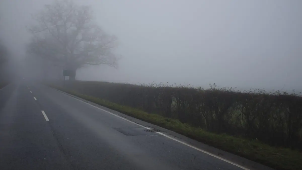
The difference between fog vs mist is visibility: both are tiny water droplets suspended in the air near the ground, but fog cuts horizontal visibility to less than 1 kilometer (about 0.6 miles), while mist leaves it at 1 kilometer or more. That is the World Meteorological Organization (WMO) standard, used by the Met Office, AEMET and weather services worldwide. Fog is simply denser mist, with more droplets per cubic meter, and in thick fog visibility can drop below 50 meters (165 feet).
Key takeaways
- The WMO defines fog as visibility under 1 km (0.6 mi) caused by water droplets; with visibility of 1 km or more, it is mist.
- In US aviation reports (METAR), fog (FG) means visibility below 5/8 statute mile and mist (BR) means 5/8 mile or more, up to about 6 miles.
- Fog forms when air near the ground cools to its dew point, or gains so much moisture that it saturates.
- The National Weather Service issues a Dense Fog Advisory when widespread fog frequently cuts visibility to 1/4 mile (400 m) or less.
- In fog, use low beams, never high beams, slow down so you can stop within the distance you can see, and turn fog lights off when visibility improves.
What is the difference between fog and mist?
Fog and mist are the same thing at different densities: below 1 km (0.6 mi) of visibility it is fog, at 1 km or more it is mist. Both are made of microscopic water droplets a few thousandths of a millimeter across, so small that they float instead of falling as drizzle.
Fog vs mist visibility in aviation
Pilots meet the same distinction in coded weather reports. In a METAR, fog is coded FG and mist BR (from the French brume). Under FAA practice in the United States, FG is reported when visibility is below 5/8 statute mile, and BR covers 5/8 mile up to about 6 miles. ICAO countries use the metric version: fog below 1,000 meters, mist from 1,000 to 5,000 meters.
Fog vs mist vs haze vs smog: how to tell them apart
Haze and smog reduce visibility with solid particles, not water droplets, so the air is usually drier and the sky looks yellowish, brownish or milky instead of white-gray. In a METAR, haze is coded HZ and smoke FU.
| Phenomenon | What causes it | Visibility | Humidity |
|---|---|---|---|
| Fog | Water droplets | Less than 1 km (0.6 mi) | Close to 100 % |
| Mist | Water droplets | 1 km (0.6 mi) or more | High |
| Haze | Dust, smoke, salt or pollution particles | Variable | Often low |
| Smog | Pollution, sometimes mixed with fog | Variable | Variable |
| Dew | Water condensed on surfaces, not in the air | Not affected | High at night |
Dew forms on surfaces rather than in the air, but for the same reason as fog: the temperature reaches the dew point. Desert dust over Spain and the Canary Islands is another visibility killer that people mistake for fog; it is called calima, and our article on calima in the Canary Islands explains where it comes from.
What causes fog to form?
Fog forms when the air touching the ground cools to its dew point, or receives so much water vapor that it saturates, and the extra vapor condenses into tiny droplets. The droplets need condensation nuclei to form on: microscopic particles of salt, dust or pollution.
Cooling is the most common route. As air cools, its relative humidity rises toward 100 %, because cold air can hold far less water vapor than warm air.
What causes fog in the morning?
Fog is most common in the morning because the coldest part of the day is just before sunrise. On clear, calm nights the ground loses heat to space, chills the air above it, and that air reaches saturation in the small hours. Long nights help, which is why fog is so frequent from October to February in the Northern Hemisphere.
What are the types of fog?
The types of fog are classified by what cools or moistens the air. These are the main ones:
- Radiation fog: forms on clear nights with light wind and moist air, as the ground radiates heat away. It is the classic fog of autumn and winter sunrises in valleys and low fields.
- Advection fog: forms when warm, moist air moves over a colder surface, such as a cold sea or snow cover. It can last for days and does not depend on the time of day. It is the summer fog that rolls through the Golden Gate in San Francisco, and the reason the sky over Lima stays gray during the southern winter, when moist Pacific air passes over the cold Humboldt Current.
- Valley fog: radiation fog that pools in valleys and basins under a temperature inversion, with cold air below and milder air above. Under a stable high pressure system it can persist for several days.
- Upslope fog: forms when wind pushes moist air up a slope and it cools as it rises.
- Steam fog (evaporation fog): forms when very cold air moves over warmer water, such as a lake or river on a frosty morning. The water seems to smoke. Over lakes and the sea it is also called sea smoke.
Freezing fog
When the temperature is below 0 °C (32 °F), fog droplets can stay liquid and freeze on contact with branches, fences, power lines and roads. This freezing fog leaves rime, a white, feathery coat of ice, and can glaze road surfaces. Our guide to frost and black ice explains why that is so dangerous for drivers.
Why does fog lift during the day?
Fog lifts because the sun warms the ground and the air above it rises above the dew point, so the droplets evaporate. Warming also stirs the air, mixing the damp layer near the ground with drier air above.
Radiation fog usually clears between mid-morning and midday. Sometimes it rises first and becomes a low layer of stratus cloud. In midwinter, with a low sun and a strong inversion, the sun may not have enough energy to break it, and the fog lasts all day. Advection fog is different: it clears when the wind changes, not when the sun comes up.
Driving in fog: safety tips
Driving in fog safely comes down to seeing and being seen: use dipped (low beam) headlights, slow down and leave much more distance to the vehicle ahead. The biggest danger is patchy fog, which can drop visibility suddenly on a road that was clear a moment before.
- Use low beams, even in daytime. Never use high beams: the light reflects off the droplets and creates a white wall in front of you.
- Use front fog lights if your car has them. In the UK, the Highway Code (rule 226) says you must use headlights when visibility is seriously reduced, generally when you cannot see more than 100 meters (328 feet). Rear fog lights may be used then, but rule 236 says you must switch them off when visibility improves, because they dazzle drivers behind you and can hide your brake lights.
- Slow down until you can stop within the distance you can see. If you can see 50 meters (165 feet), you must be able to stop in less than that.
- Increase your following distance and do not fix your eyes on the taillights ahead: if that car brakes hard, you will have no margin.
- Follow the right edge line (left in the UK and Ireland), not the center line, to stay out of oncoming traffic.
- Do not overtake and avoid sudden lane changes.
- Keep the windshield clear with the air conditioning and wipers.
- If you must stop, pull as far off the road as you can and switch on your hazard lights.
What to do when visibility improves
When visibility improves, switch off your front and rear fog lights and go back to normal low beams. Do not speed up straight away: fog often lies in patches in dips and near rivers. If the National Weather Service has issued a Dense Fog Advisory, or there is a fog warning from the Met Office or your national weather service, consider waiting until it lifts.
How to check for fog with Clima de Hoy
Clima de Hoy shows current visibility for each city in kilometers, next to humidity and dew point; when visibility is more than 10 km it appears as "> 10 km". If the temperature and the dew point are very close and the night will be clear and calm, fog is likely.
In the hourly view, the fog icon shows the hours when the model expects it. That is useful in places with frequent winter fog, such as the hourly forecast for London or the hourly forecast for Burgos in northern Spain, to decide what time to set off.
Frequently asked questions
Is mist the same as fog?
Mist and fog are both water droplets suspended in the air, but they are not the same. The WMO calls it fog when visibility is below 1 km (0.6 mi) and mist when it is 1 km or more. Fog is denser and wetter, and much more dangerous for driving and flying.
What is the difference between fog and a cloud?
There is no physical difference: fog is a cloud that touches the ground. Most fog forms from the surface up as the air cools, while clouds form higher up, usually when air rises and cools. A low stratus cloud that drifts onto a hill is fog for anyone standing on that hill.
What lights should you use when driving in fog?
Use low beam headlights and, if your car has them, front fog lights. Never use high beams, because the light bounces off the droplets and dazzles you. Use rear fog lights only when visibility is seriously reduced, around 100 meters (328 feet) or less, and switch them off as soon as it improves.
What is a Dense Fog Advisory?
A Dense Fog Advisory is a National Weather Service alert issued when widespread fog is expected to reduce visibility frequently to 1/4 mile (about 400 meters) or less. It means travel will be hazardous, especially on highways. Slow down, use low beams and allow extra time, or delay your trip until the fog lifts.
Weather in your city
- Weather in Ciudad de México
- Weather in Londres
- Weather in Nueva York
- Weather in Bogotá
- Weather in Madrid
- Weather in Buenos Aires
- Weather in París
- Weather in Barcelona
- Weather in Valencia
- Weather in Sevilla
- Weather in Málaga
- Weather in Bilbao