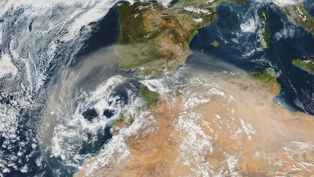
Calima in the Canary Islands is a haze of very fine dust, mostly sand and clay from the Sahara, that turns the sky yellow or orange, cuts visibility and worsens air quality. It is common in the islands because they lie about 100 km (62 miles) off the African coast, and an episode can last from a few hours to several days. The word calima is simply Spanish for dust haze, and it is what you will hear on Canarian radio and in weather warnings.
Key takeaways
- Calima is airborne dust from the Sahara and the Sahel, not humidity or city pollution.
- It reaches the Canary Islands with east and southeast winds, a situation islanders call "tiempo sur" (southern weather).
- Most episodes last one to three days; some go on for a week or more.
- It raises PM10 particles, for which the WHO daily guideline has been 45 µg/m³ since 2021.
- The episode of February 22 to 25, 2020 was, according to Spain's weather agency AEMET, probably the most intense dust intrusion in the Canary Islands since instrumental records began.
What is calima?
Calima is a weather phenomenon made of dry solid particles suspended in the air, which the World Meteorological Organization (WMO) classes as a lithometeor. Unlike fog or mist, it is not made of water droplets but of mineral dust so fine that it can stay in the air for days.
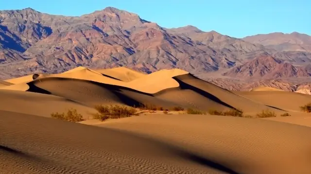
The dust comes mainly from the deserts of North Africa. Wind lifts sand and clay off the ground, carries it several kilometers up and transports it hundreds or thousands of kilometers. The coarser grains fall out quickly; the finest can reach central and northern Europe and, in summer, the Americas.
A calima day is easy to recognize: a whitish or sepia sky, a pale sun you can almost look at, distant mountains that vanish and a thin film of dust on cars and terraces.
Why does calima hit the Canary Islands?
Calima reaches the Canary Islands when the wind blows from the east or southeast, bringing air straight from Africa instead of the usual northeast trade winds. It typically happens when high pressure sits over North Africa or the western Mediterranean and low pressure lies to the west or southwest of the islands, creating a corridor of wind that sweeps the desert and pushes the dust over the Atlantic.
Winter calima and summer calima
There are two quite different kinds of episode:
- In winter, mainly from December to March, the dust tends to travel low, close to the ground. That is why winter episodes do the most damage to air quality and visibility, as in February 2020.
- In summer, the dust travels higher, inside a layer of very hot Saharan air. When that layer sinks, calima arrives with very high temperatures and dry air, which adds to the risk of heat stroke.
Calima in Lanzarote and Tenerife
Lanzarote and Fuerteventura, the islands closest to Africa, usually feel calima first and most strongly, but Gran Canaria and Tenerife also get severe episodes. In Tenerife the dust can stay below the sea of clouds on the north coast or, when it arrives higher up, wrap the summits of Teide while the coast stays clearer.
How long does calima last in Tenerife and the Canary Islands?
A calima episode usually lasts one to three days, although some go on for a week or more. It ends when the wind changes direction, normally when the northeast trade winds return, or when rain washes the dust out of the air.
Calima happens several times a year, with the most intense low-level episodes in winter. It is not predictable weeks ahead, but weather models see the wind shift a few days in advance, and forecasts of dust and air quality cover the next several days.
Is calima bad for your health?
Calima can be bad for your health because it raises the concentration of airborne particles, which you breathe in and which can irritate the airways and worsen lung and heart conditions. Two sizes are measured:
- PM10: particles smaller than 10 microns. They reach the nose, throat and bronchi.
- PM2.5: particles smaller than 2.5 microns. They can get deep into the lungs.
| Reference | PM10 daily mean | PM10 annual mean |
|---|---|---|
| WHO guidelines (2021) | 45 µg/m³ | 15 µg/m³ |
| Current legal limit in the EU and Spain | 50 µg/m³ (no more than 35 days a year) | 40 µg/m³ |
The WHO values are health recommendations; the EU values are legal limits. During a strong calima, stations can record PM10 several times above these figures. In the February 2021 episode, AEMET reported values above 700 µg/m³ in Santa Cruz de Tenerife.
The people most at risk are those with asthma, COPD or other lung disease, people with heart disease, young children, older adults, pregnant women and anyone doing hard exercise outdoors. Typical symptoms are itchy eyes, a sore throat, cough and a dry nose, and in sensitive people shortness of breath or an asthma attack. If you have severe breathlessness, chest pain or an attack that does not respond to your usual treatment, call 112, the emergency number in Spain.
What happened in the February 2020 calima?
The calima of February 22 to 25, 2020 was, according to AEMET, probably the most important Saharan dust intrusion in the Canary Islands since instrumental records began. It coincided with the Carnival weekend and with very strong east winds, with gusts of up to 120 km/h (75 mph).
Visibility fell to a few hundred meters in many places, and all the airports in the archipelago were closed on February 22, most of them until February 24. According to NASA, close to 800 flights were canceled or diverted. Several towns suspended Carnival events, and the wind fanned wildfires on Gran Canaria and Tenerife. It is still the benchmark against which every new calima is measured.
What should you do when there is calima?
When there is calima, the most effective step is to cut the time and effort you spend outdoors, especially if you are in a risk group.
- Check the air quality before going out, and follow AEMET and Canary Islands Government warnings.
- Skip hard outdoor exercise: train indoors or wait for another day.
- Keep doors and windows closed during the dustiest hours and air the room when the air improves.
- Keep your medication at hand if you have asthma or COPD.
- Wear a well-fitted FFP2 (or N95) mask if you are sensitive and must be outside: it filters much of the dust.
- If you drive, use dipped headlights, leave more distance and rinse the windshield with plenty of water before using the wipers, so the grit does not scratch the glass.
- If you are flying, check your flight status: strong episodes can disrupt airports.
Calima weather warnings in the Canary Islands
AEMET issues warnings for airborne dust when calima cuts visibility sharply, using the same yellow, orange and red levels as for other hazards; our guide to weather warning colors explains what each level means. The Canary Islands Government can also declare a pre-alert or alert for calima, with advice for the public and for vulnerable people.
Saharan dust in Florida, Texas and the Caribbean
The same Saharan dust also crosses the Atlantic: in summer, mainly from June to August, the Saharan Air Layer carries dust over the ocean to the Caribbean and as far as Florida and Texas. NOAA's hurricane researchers note that this dry, dusty air can weaken tropical storms, which is one reason the dust gets so much attention during the hurricane season.
On the US side the dust is usually high up and diluted, so the main effects are hazy skies, vivid sunsets and, on some days, worse air quality for sensitive people. In the UK, strong southerly winds sometimes bring Saharan dust too, and rain falling through it leaves a film of reddish mud on cars.
How to check calima and air quality on Clima de Hoy
Every city page on Clima de Hoy shows the current air quality with the European index, grouped into five levels from good to very poor, along with PM10, PM2.5, ozone and nitrogen dioxide. The data come from Open-Meteo, which uses the air quality models of the European Copernicus service.
During calima, watch PM10 above all: it is the value that rises most. You can check it on the weather in Las Palmas de Gran Canaria and the weather in Santa Cruz de Tenerife. To see whether the wind is about to turn east or south, the rain forecast map shows the forecast wind and rain for the coming hours and days.
Frequently asked questions
What does calima mean?
Calima is the Spanish word for a haze of dust in the air. In the Canary Islands and Spain it refers to Saharan dust carried by east or south winds, which turns the sky yellow or orange and lowers visibility. It is a dry haze, not fog.
Is calima dangerous?
Calima can be harmful because it raises the PM10 and PM2.5 particles you breathe. For most healthy people the discomfort is mild and short-lived, but for people with asthma, COPD or heart disease it can worsen symptoms. During a strong episode it is best to limit effort outdoors.
How long does calima last in Tenerife?
Calima in Tenerife usually lasts one to three days, although some episodes last a week or more. It ends when the northeast trade winds return or when rain cleans the air. Forecasts can usually see the end of an episode a few days ahead.
Why does calima turn the sky orange?
The sky turns orange or reddish because dust particles scatter and absorb sunlight differently from the molecules of clean air. The thicker the dust, the more the blue fades and the more yellow, ochre and orange tones dominate.
Does a mask help against calima?
A well-fitted FFP2 or N95 mask filters much of the dust and is useful for sensitive people who have to be outdoors. Surgical masks protect much less. Even so, the most effective measure is to reduce time and effort outdoors during the episode.
Weather in your city
- Weather in Ciudad de México
- Weather in Londres
- Weather in Nueva York
- Weather in Bogotá
- Weather in Madrid
- Weather in Buenos Aires
- Weather in París
- Weather in Barcelona
- Weather in Valencia
- Weather in Sevilla
- Weather in Málaga
- Weather in Bilbao